Example Flow: Writing a Log Database
This article outlines how to use Flows to generate a new log database. This requires using three flows building blocks:
- LogInput
- CpiLogCalc
- LogOutput
The assembled flow is shown below:
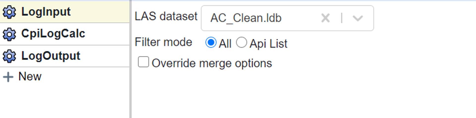
In the LogInput block I choose my original log database and select to use all the wells.
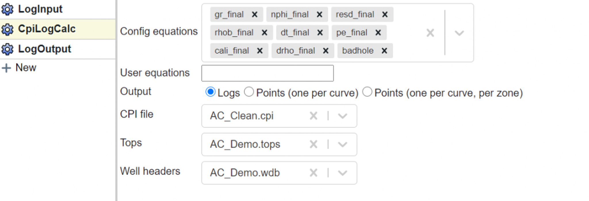
In the CpiLogCalc block I add the Config equations that I want to write. In this case the I have selected the “_final” curves and the badhole flag because I wanted to have the repaired curves in my export. Note, I could have added any curve name available in the CPI Config (see curve names here).

And finally I use the LogOutput block to write out a new log database. Note that this database will include both the curves in my Config equations list as well the imported curves.
Tags
Related Insights
DCA: Type well curves
In this video I demonstrate how to generate a well set filtered by a number of criteria and generate a multi-well type curve. Before starting this video you should already know how to load your data and create a DCA project. If not, please review those videos. Type well curves are generated by creating a decline that represents data from multiple wells.
DCA: Loading Production data
In this video I demonstrate how to load production and well header data for use in a decline curve analysis project. The first step is to gather your data. You’ll need: Production data – this can be in CSV, Excel, or IHS 298 formats. For spreadsheet formats you’ll need columns for API, Date, Oil, Gas, Water (optional), and days of production for that period (optional). Well header data – this can be in CSV, Excel, or IHS 297 formats.
Sample data to get started
Need some sample data to get started? The files below are from data made public by the Wyoming Oil and Gas Commission. These will allow you to get started with petrophysics, mapping, and decline curve analysis. Well header data Formation tops data Deviation survey data Well log data (las files) Production data (csv) or (excel) Wyoming counties shapefile and projection Wyoming townships shapefile and projection Haven’t found the help guide that you are looking for?